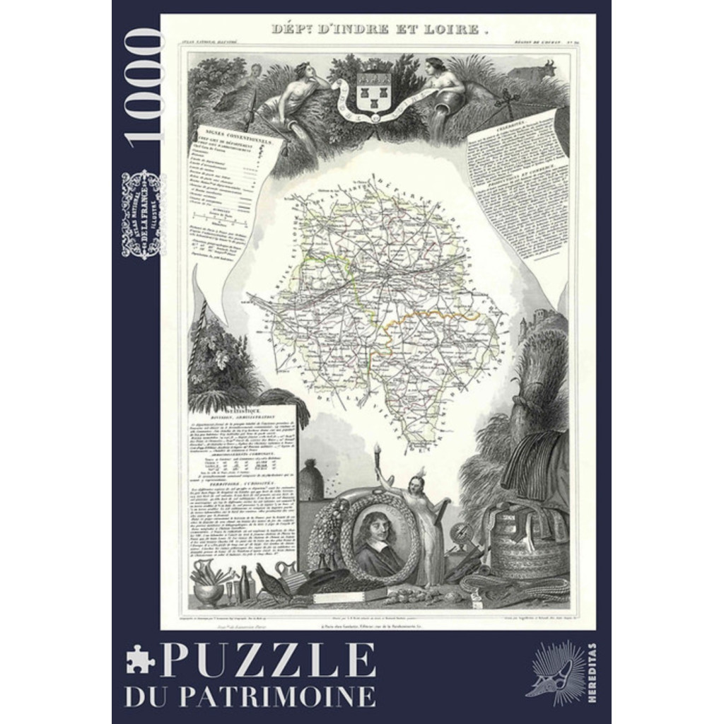
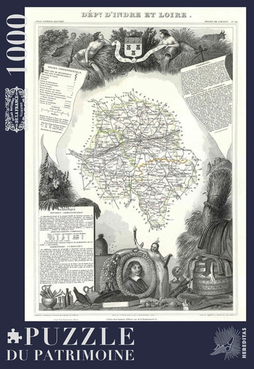
Discover the charm of the Touraine region through this delicate antique map of the Indre-et-Loire department, taken from Levasseur’s *Atlas national illustré de la France* (National Illustrated Atlas of France), engraved in the 19th century.
The illustration depicts the department with its roads, municipalities, and boundaries, all finely traced and accented with touches of color. Tours, Chinon, and Loches appear amidst a rich, engraved backdrop: two female allegorical figures pour water from their urns on either side of a coat of arms, accompanied by a cow, a beehive, sheaves of wheat, a grapevine, a hilltop castle, and—at the bottom—a portrait framed by a wreath of fruit, alongside an allegorical figure holding a torch. The margins feature statistical data, a list of notable figures, and a legend for the symbols used, all reflecting the meticulous care put into this work.
With its refined graphic style and subtle shades of gray, this map serves as a true testament to France’s cartographic heritage and the art of engraving.
This 1000-piece puzzle offers a captivating challenge, thanks to its wealth of detail, intricate lines, and tiny place names.
An ideal choice for those who love the Touraine region, cartography, or antique engravings.
Once assembled, it becomes a stunning decorative piece that celebrates the rich heritage of the Touraine area.
Technical specifications:
- 1,000 pieces,
- Finished puzzle size: 48 x 68 cm,
- Box dimensions: 34 x 24 x 5 cm,
- Soft-touch finish,
- Matte finish,
- Cotton pouch,
- Poster included,
- 0% plastic.